Research in GEO-AI & spatial intelligence
Our research is applied: every study is aimed at a tool someone will use to make a better decision.
Papers & studies
- 2025
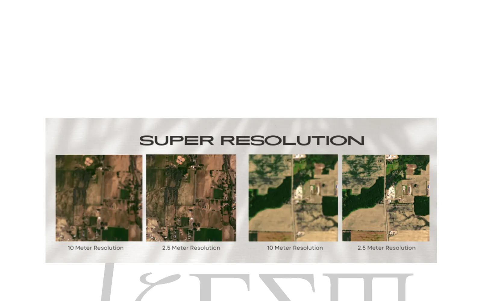
Advancing satellite imagery super-resolution for agricultural monitoring
Deep learning methods that enhance low-resolution satellite images so small fields, roads and settlements can be mapped reliably.
Ongoing research
GeoAI · Remote sensing
- 2025
Integrated food security monitoring with Earth observation data in Karnali Province
Combining remote sensing indicators with regional data to support food security planning and early warning.
Applied study
GeoAI · Food security
- 2026
Grounded question answering over geospatial reports using RAG
Evaluating retrieval-augmented generation for answering planners' questions from technical and policy documents with citations.
Working paper
AI Systems · RAG
Research areas
What we study, and why
We research problems that block real projects. A study is worth doing when its result changes a decision, a tool or a method that people in Nepal and similar contexts actually use.
- GeoAI and remote sensing
- Machine learning on satellite, aerial and drone imagery: super-resolution, land cover and change detection where ground data is scarce.
- Food security and agriculture
- Turning imagery, weather and survey data into early, explainable signals about crops and vulnerable districts.
- RAG for technical documents
- Retrieval-augmented assistants that answer from reports and policy documents, with sources, and how to test that they are right.
- Reality capture and immersive 3D
- Photogrammetry, laser scanning and Gaussian splatting to record places, and how to publish them for the web and headsets.
How we work
Applied, measured and shared
- We start from a decision someone needs to make, not from a technique.
- We test on data held back from training and report accuracy, error and uncertainty honestly.
- We prefer free and open data, such as Sentinel-2 and Landsat, so results can be repeated.
- We publish what we learn as plain-language material on our Learn pages.
Start a project
Partner with us on research
We collaborate with universities, research institutes and agencies on GeoAI studies, grant proposals and pilots.